Geospatial data is information that describes objects, events or other features that have a physical position on or near the earth’s surface.
Geospatial data typically combines location information and attribute information with temporal information.
In the short term, the location provided may be static, for example the location of a piece of equipment, an earthquake event, children living in poverty and dynamic location such as a moving vehicle or pedestrian, the spread of an infectious disease.
Large sets of spatial data obtained from a variety of sources in various formats, such as census data, satellite imagery, weather data, mobile phone data, drawn images, and social media data, are all examples of geospatial data.
When geospatial data can be found, shared, analysed, and combined with standard business data, it is most useful.
The debut of Google Maps in 2005 was one of the most significant events in geospatial history. It made mapping technology accessible to the general public. However, the seeds of what we now know as geospatial technology were planted in 1832.
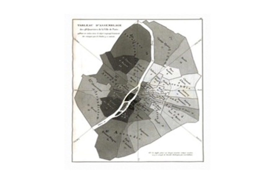
During a cholera outbreak in Paris that year, French geographer Charles Picquet drew one of the first heat maps to illustrate where illness was most prevalent. When cholera invaded London in 1854, physician John Snow followed in the footsteps of his Parisian counterpart.
He employed spatial analysis of the data to show the link between contaminated water sources and cholera, in addition to creating a map depicting the location of cholera deaths.
Roger Tomlinson, who pioneered the notion of a Geographic Information System (GIS) in the 1960s, elevated classical cartography to a new level.
For the first time, photographs of the Earth’s surface and human activities were delivered by satellites focused on national security, science, and commercial operations, offering up more methods to visualise data.
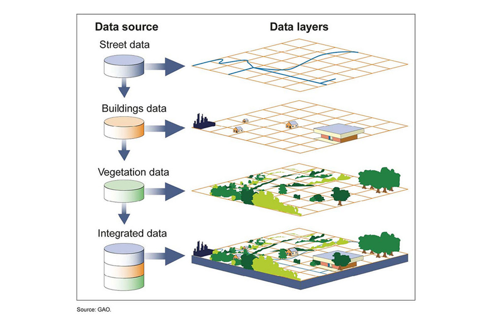
A geographic information system (GIS) combines a base map with data acquisition, modification, and management. A GIS map can hold an infinite amount of information. Users can utilise this geospatial data to not only view and analyse data, but also to better understand trends, correlations, and patterns.
GIS was enhanced further until 2005, when Google Maps released a user-friendly version for the general public. Geospatial technology has progressed from a desktop to a cloud-based solution since then. Geospatial databases used to be proprietary, but open source software has altered that, allowing more people to access this type of data.
Geospatial AI
Places a geographic component on machine learning. App users can provide real-time information about traffic or other conditions in their surroundings. Myriads of contributors improve the accuracy of geospatial data, allowing for better predictions when managing things like traffic flow.
Autonomous Vehicles
The eye of an autonomous vehicle is LiDAR (Light Detection and Ranging), which is a sensing method that uses pulsed laser light to measure variable distances. Geospatial technology make LiDAR possible and mapping companies will take it to the next level to make autonomous driving safer and more accessible.
Mapping as a Service
Not every map found online is high-resolution. But geospatial mapping technology can make on-demand maps of any location desired. The maps can be created based on customer needs and used for any number of industries, including construction. Geospatial imagery and the Mapping as a Service market could reach $8 billion by 2025.
Drones
Drones used for aerial mapping will become more common. Combined with GIS and high precision sensors, the drone-capture images can fly over acres of land to gather data to influence everything from farming to urban planning.
Cadastral Survey
Aerial Mapping Survey
Engineering Survey
Hydrographic Survey
Underground Utilities
Detection & Mapping
Geographical Infomation System (GIS)
Terrestrial Laser Scanning
Mobile Mapping System (MMS)
Building Information Modelling (BIM)
3D Laser Scanning Services
As-Built Survey Services
Topographical Survey
Kuala Lumpur
Suite L11-21, Tower 1, Wangsa 118, No.8, Jalan Wangsa Delima, Wangsa Maju, 53300, Kuala Lumpur
T :+(6)03-4144 2344
T: +(6)0386878415
F :+(6)03-4144 2644
E: sgskl@setiageosolutions.com
Whatsapp : +(6)0386878415
© 1959 – 2026. Setia Geosolutions Sdn. Bhd. (ISO 9001:2015 Certified Company). All Right Reserved | Powered by keepdesign
No.152A, Jalan Tasek Timur,
Pusat Perdagangan Tasek Indra,
31400 Ipoh, Perak Darul Ridzuan