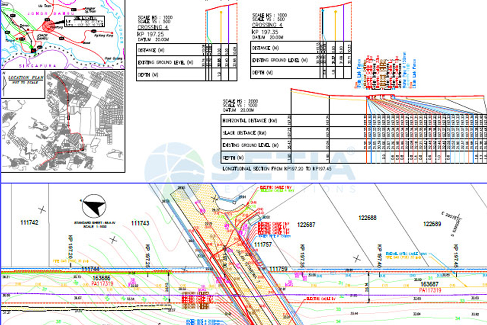
Survey using geophysical techniques to create a digital representation of underneath features.
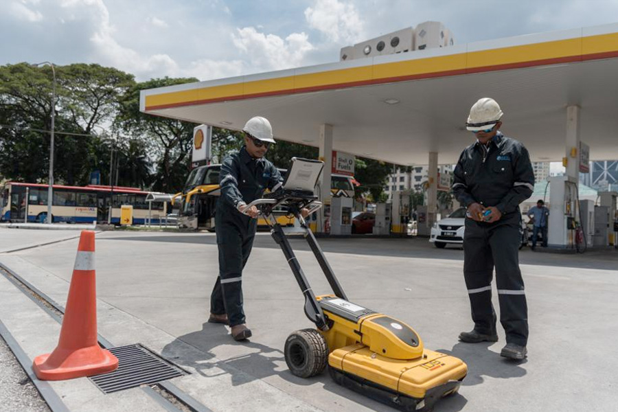
The survey composes a highly detailed below surface profile using the latest technology, including Ground Penetrating Radar (GPR) equipment, and Electro-Magnetic Locators (EML).
This technology is used to interpret reflected signals from structures, services, buried objects, and layers beneath the ground ultimately providing vital detail required for project planning ahead of any prospective works.
This kind of survey capable to identify the position and labelling public utility mains which are located underground.
These mains may include utilities lines for telecommunication, electricity distribution, natural gas, water mains and wastewater pipes.
There are two main types of underground utility survey methods known as EML and GPR. Most surveys of this nature will require a combination of the two to ensure that the map produced is as accurate and comprehensive as it possibly can be.
Electro Magnetic Locator (EML) technology is the most popular data collection method used in underground utility surveying and works by tracing the signals emitted by targets beneath the ground such as:
Ground Penetration Radar (GPR) technology is used to locate objects which, essentially, are of a different material to the surrounding environment.
Although this type of radar is not as exact as EML, it is useful for finding the location of objects buried underground, which would otherwise be invisible.
This method usually to be used as cross-checking for data comparison that resulted from EML.
The feature or utilities that can be trace as below:
Cadastral Survey
Aerial Mapping Survey
Engineering Survey
Hydrographic Survey
Underground Utilities
Detection & Mapping
Geographical Infomation System (GIS)
Terrestrial Laser Scanning
Mobile Mapping System (MMS)
Building Information Modelling (BIM)
3D Laser Scanning Services
As-Built Survey Services
Topographical Survey
Kuala Lumpur
Suite L11-21, Tower 1, Wangsa 118, No.8, Jalan Wangsa Delima, Wangsa Maju, 53300, Kuala Lumpur
T :+(6)03-4144 2344
T: +(6)0386878415
F :+(6)03-4144 2644
E: sgskl@setiageosolutions.com
Whatsapp : +(6)0386878415
© 1959 – 2026. Setia Geosolutions Sdn. Bhd. (ISO 9001:2015 Certified Company). All Right Reserved | Powered by keepdesign
No.152A, Jalan Tasek Timur,
Pusat Perdagangan Tasek Indra,
31400 Ipoh, Perak Darul Ridzuan