
The main objectives for site selection as follows:-
GIS for site selection has many advantages. We can classify the advantages in the scope of Economic, Environmental and Operational Efficiencies.
Using GIS to analyze proximity of solar farm to consumers. Electricity and distribution losses has direct relation with distances to consumers. Ideally its better to build power stations near to residential area or power lines.
Lastly, reducing civil construction cost by selecting the most suitable site.
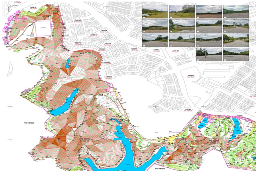
Input of geospatial data can be use in GIS application for data analysis in Environmental Impact Studies. As an example, aerial mapping will provide current imagery of the site conditions.
Various other spatial data can also be extracted from aerial images using suitable sensors available such as multispectral, infra red etc. This information can be used to provide valuable input for the environmental impacts studies.
Optimizing geospatial data for selection of solar farm site location. GIS data can be easily integrated and performed analytical studies based of topography, temperature, precipitation , humidity ,etc.
Kuala Lumpur
Suite L11-21, Tower 1, Wangsa 118, No.8, Jalan Wangsa Delima, Wangsa Maju, 53300, Kuala Lumpur
T :+(6)03-4144 2344
T: +(6)0386878415
F :+(6)03-4144 2644
E: sgskl@setiageosolutions.com
Whatsapp : +(6)0386878415
© 1959 – 2026. Setia Geosolutions Sdn. Bhd. (ISO 9001:2015 Certified Company). All Right Reserved
No.152A, Jalan Tasek Timur,
Pusat Perdagangan Tasek Indra,
31400 Ipoh, Perak Darul Ridzuan