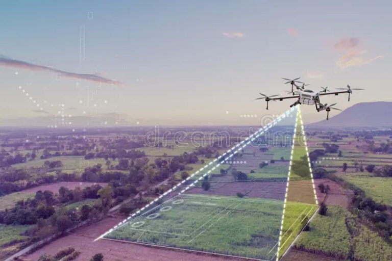
Planners, engineers and land developers often need photogrammetry surveys for large areas of land. Data obtained from Photogrammetry Surveys are benecial to the government agencies, the mining industry, oil and gas, property and infrastructure as well as plantations.
The use of aerial photogrammetry provides an advantage to the design and construction of pipeline work, railroads, highways and locating possible areas to situate new structures such as oil bearing structures for the oil and gas industry as Aerial Photogrammetry Survey constructs a three-dimensional point cloud used to generate the same topographic maps, digital terrain models, meshes, and orthophotos that architects and engineers rely on for design and build work.

UAV measured surveys is extensively used in construction sites, land, quarries, mines and other areas where this remote technique can replace the need for staff on the ground, reducing health and safety risks and lowering costs.
Planners, engineers, government agencies, and developers utilize UAV qualitative datasets. Property and Infrastructure, the Government, Agriculture and Plantations, Utilities, Oil and Gas industries benet from UAV mapping especially in making well-informed decisions in regards to real estate and infrastructure construction management.
Airborne laser proling produces data which are benecial to professional ranging from civil engineers and forestry engineers to archaeologists and geologists by producing Topographic data and deformation monitoring.
Airborne laser proling is also able to produce clear proes of landscapes used for design and planning purposes, providing measurements of land surface features. It is also benecial for a wide range of industries, namely, the Mining, Infrastructure, Urban Planning, Property and Infrastructure, Government, Plantation, and Environmental Industries.
Kuala Lumpur
Suite L11-21, Tower 1, Wangsa 118, No.8, Jalan Wangsa Delima, Wangsa Maju, 53300, Kuala Lumpur
T :+(6)03-4144 2344
T: +(6)0386878415
F :+(6)03-4144 2644
E: sgskl@setiageosolutions.com
Whatsapp : +(6)0386878415
© 1959 – 2026. Setia Geosolutions Sdn. Bhd. (ISO 9001:2015 Certified Company). All Right Reserved
No.152A, Jalan Tasek Timur,
Pusat Perdagangan Tasek Indra,
31400 Ipoh, Perak Darul Ridzuan