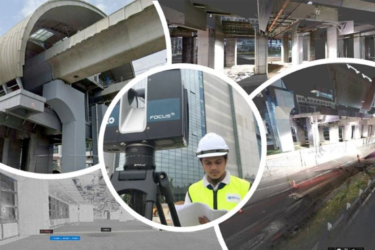
Professional archaeologists and Property Developers utilize data collected from TLS surveys for a variety of environments to support a wide range of geoscience investigations such as detailed mapping of fault-surface roughness. Major Market Segments in Property and Infrastructure, Environmental, Government, Oil and Gas Industries benefit from TLS geodata as repeat TLS surveys allow the imaging and measurement of surface changes through time, arising, for example, from erosion or landslides.
Kuala Lumpur
Suite L11-21, Tower 1, Wangsa 118, No.8, Jalan Wangsa Delima, Wangsa Maju, 53300, Kuala Lumpur
T :+(6)03-4144 2344
T: +(6)0386878415
F :+(6)03-4144 2644
E: sgskl@setiageosolutions.com
Whatsapp : +(6)0386878415
© 1959 – 2026. Setia Geosolutions Sdn. Bhd. (ISO 9001:2015 Certified Company). All Right Reserved
No.152A, Jalan Tasek Timur,
Pusat Perdagangan Tasek Indra,
31400 Ipoh, Perak Darul Ridzuan