Hydrographic survey plans are drawn to suitable scales and is utilized by engineers to prepare engineering designs for submission to the relevant authorities for approval. The high resolution
hydrographic information in the form of seabed imagery provides a basis for oil and gas or utility industries to make decisions on matters such as where to locate subsea installations such as pipelines or communications cables.
Hydrographic information is highly useful for resource development, marine construction, transportation planning, as well as Oil and Gas exploration. This survey method also provides coastal mapping for projects involving coastal and waterfront developments.
Hydrographic surveys are essential for offshore oil and gas, renewable energy (wind farms), port authorities, dredging contractors, coastal infrastructure developers, subsea cable installations, and marine construction projects. Accurate seabed data supports safe engineering design and regulatory approval.
Professional hydrographic surveys typically utilise:
The choice of equipment depends on required accuracy, water depth and project scope.
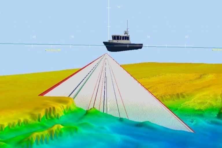
Accuracy depends on survey methodology and equipment calibration. High-resolution multibeam systems can achieve centimetre-level vertical accuracy when properly calibrated and conducted under controlled conditions. Compliance with IHO (International Hydrographic Organization) standards further ensures reliability.
Hydrographic surveys are typically required:
Early surveying reduces engineering risks and prevents costly redesigns.
Clients typically receive:
Deliverables are usually provided in CAD, GIS or compatible engineering formats.
Project duration depends on:
Small coastal surveys may take a few days, while offshore energy projects can require several weeks including processing and reporting.
Contact us today and get the assistance you need promptly.
Cadastral Survey
Aerial Mapping Survey
Engineering Survey
Hydrographic Survey
Underground Utilities
Detection & Mapping
Geographical Infomation System (GIS)
Terrestrial Laser Scanning
Mobile Mapping System (MMS)
Building Information Modelling (BIM)
3D Laser Scanning Services
As-Built Survey Services
Topographical Survey
Kuala Lumpur
Suite L11-21, Tower 1, Wangsa 118, No.8, Jalan Wangsa Delima, Wangsa Maju, 53300, Kuala Lumpur
T :+(6)03-4144 2344
T: +(6)0386878415
F :+(6)03-4144 2644
E: sgskl@setiageosolutions.com
Whatsapp : +(6)0386878415
© 1959 – 2026. Setia Geosolutions Sdn. Bhd. (ISO 9001:2015 Certified Company). All Right Reserved | Powered by keepdesign
No.152A, Jalan Tasek Timur,
Pusat Perdagangan Tasek Indra,
31400 Ipoh, Perak Darul Ridzuan