
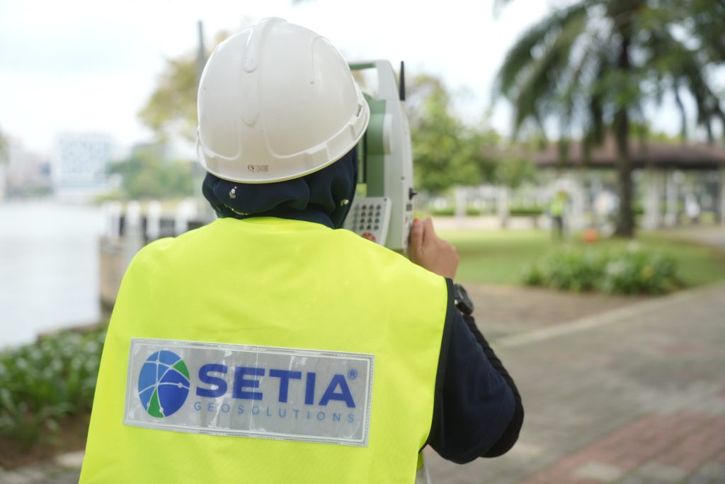
As-Built Survey Services in Malaysia

as built survey
as-built survey 2

Accurate, compliant, and reliable documentation of your completed construction.

Setia Geosolutions delivers professional as-built survey services to capture the true condition of your project after construction. Using advanced geospatial technologies and over 50 years of industry expertise, we provide precise, legally reliable data to support compliance, asset management, and future development.

What is an As-Built Survey?

An as-built survey is conducted after construction to document the actual dimensions, locations, and conditions of a structure as it exists on site.

Unlike design drawings, which represent planned intent, an as-built survey reflects what has been physically constructed, including:

  • Building footprint and orientation
  • Floor levels and elevations
  • Structural elements (walls, columns, etc.)
  • Setbacks and boundaries
  • Utilities and services (where applicable)

In simple terms: it shows reality, not design.

More information may refer : What Is an As-Built Survey? A Complete Guide for Property Owners in Malaysia

Why Do You Need an As-Built Survey?

Regulatory Compliance & Approvals

In Malaysia, construction projects often require accurate documentation for:

  • Completion certification
  • Regulatory submissions
  • Zoning and setback verification

An as-built survey ensures your project meets all compliance requirements.

Verify Construction Accuracy

Changes during construction are common. An as-built survey:

  • Confirms whether the build matches approved plans
  • Identifies discrepancies early
  • Provides a verified final record

Legal Protection & Dispute Resolution

A certified as-built survey serves as a legally reliable record when prepared by a licensed land surveyor.

It helps resolve:

  • Boundary disputes
  • Contractor disagreements
  • Ownership and encroachment issues

Support Future Renovations & Development

Before any extension or modification, accurate site data is essential.
An as-built survey provides the foundation for:

  • Renovation planning
  • Structural upgrades
  • Infrastructure expansion

Essential for Property Transactions

Buyers, valuers, and solicitors often require verified building data for:

  • Property sales
  • Asset valuation
  • Ownership documentation

Benefits of Our As-Built Survey Services

High Accuracy with Advanced Technology

We utilise modern surveying methods such as:

  • GNSS and total stations
  • Terrestrial laser scanning
  • Mobile mapping systems

These technologies ensure highly precise and reliable data capture.

Faster Approvals & Reduced Delays

Accurate documentation helps streamline submissions and approvals with authorities.

Cost Savings & Risk Reduction

Avoid costly rework, design conflicts, and construction errors in future phases.

Complete and Reliable Documentation

Receive detailed:

  • CAD drawings
  • Digital models
  • Survey reports

All reflecting real-world conditions.

Improved Asset & Facility Management

Accurate as-built data enables:

  • Efficient maintenance planning
  • Better space utilisation

Long-term asset tracking

What’s Included in Our As-Built Survey

Our as-built surveys are tailored to your project requirements and may include:

  • Building footprint and layout
  • Floor levels and elevations
  • Structural elements and features
  • Boundary setbacks and site positioning
  • Road access and surrounding features
  • Utility and service mapping (where required)


How We Conduct As-Built Surveys

1. Site Measurement

Our surveyors collect accurate on-site data using:


2. Data Processing & Validation

All collected data is processed and verified to ensure precision and consistency.


3. Drawing & Documentation

We produce:

  • As-built drawings (CAD/PDF)
  • 3D models (if required)
  • BIM-ready data for advanced projects

Advanced Technology: Laser Scanning & BIM

For complex or high-value projects, we utilise Terrestrial Laser Scanning (TLS) to capture millions of data points and generate:

  • Highly accurate point clouds
  • Detailed 3D representations
  • BIM-integrated datasets

This significantly improves accuracy and reduces manual errors.
More information may refer : Terrestrial Laser Scanning (TLS) in Surveying and BIM

Who Needs an As-Built Survey?

Our services support a wide range of industries, including:

When Should You Conduct an As-Built Survey?

  • After construction completion
  • Before project handover
  • Prior to renovations or extensions
  • During property sale or transfer
  • When drawings are missing or outdated

Frequently Ask Question (FAQ) About 3D Laser Scanning Service

An as-built survey is a detailed measurement of a building or site after construction is completed. It shows the exact size, position, and layout of what has actually been built, rather than what was originally planned.

It ensures that the completed structure is accurately documented. This is important for:

  • Future renovations
  • Legal and compliance purposes
  • Avoiding costly mistakes

It essentially provides a reliable reference for anything you do next.

As-built surveys are commonly used by:

  • Property owners
  • Developers
  • Contractors
  • Architects and engineers

Anyone involved in construction, property management, or renovation can benefit from it.

It typically includes:

  • Building dimensions and layout
  • Floor levels and elevations
  • Structural features (walls, columns)
  • Site positioning and boundaries

The level of detail can vary depending on the project requirements.

An as-built survey is usually done:

  • After construction is completed
  • Before handing over the project
  • Before starting renovation or extension works

Getting it done at the right time ensures accurate and useful documentation.

Not sure if you need an as-built survey?

Have a quick chat with our team or browse our website to see how we can assist with your project.

Get In Touch

Your journey towards effective solutions begins with a simple message. We’re here to listen, assist, and transform your queries into clarity. Connect now and let’s create possibilities together.
1 Step 1
keyboard_arrow_leftPrevious
Nextkeyboard_arrow_right

List of Experience :

  • Land Surveyor for Proposed Development of Legasi Residen Kampong Bharu on Lot 3338, Jalan Raja Alang, Kampong Bharu, Kuala Lumpur.
  • Land Survey Works for the Central Spine Road Project- Gua Musang To Kg Relong.
  • Land Survey Works for The Pekan Agropolitan Project in The District of Pekan, Pahang.
  • Site Survey For Proposed Construction Of Brunei Darussalam Chancery Building At Putrajaya Diplomatic Enclave, Malaysia.
  • Construction of Water Treatment Resource System at Perkampungan Orang Asli Negeri Pahang.
  • Proposed Fourth Lane Widening Between Bukit Lanjan And Jalan Duta Toll Plaza.
  • Proposed 640 Units Of Prima Homes At Padang Temu, Melaka Tengah, Melaka.
  • Survey Works For Verification Of Existing Data And Establishing Recent Data At Kuantan Airport, Sandakan Airport, Lahad Datu Airport, Tawau Airport, Labuan Airport And Limbang Airport.
  • Proposed Re-Alignment and Right Of Way (ROW) Setting Out of Railway Route for East Coast Railway Line (ECRL).
  • Re- Alignment Pipe Survey Mapping, Verification And New Pipe Marker Installation At Tronoh Lateral for Petronas Gas Berhad (PGB).
  • Strip survey, Demarcation Survey and Right of Way (ROW) Setting Out at Petronas Seremban for Petronas Gas Berhad (PGB).
  • Topographic Survey, and Demarcation Survey for Petron Port Dickson Refinery
  • Transmission Line Survey for PMU 275/132 Kv Ujong Pasir and Transmission Line of DC Lilo 275kv PMU Melaka (MCCA) – PMU Sg. Mati (SMTI) to PMU 132/33kv Ujung Pasir.
  • Transmission Line Survey and Existing Development of Tenaga Nasional Berhad.
  • Proposed Development of The Water Treatment Plant And Water Treatment System at Selangor And Wilayah Persekutuan Kuala Lumpurd (TNB) Middle Zone.
  • Transmission Line Survey for 132Kv PMU Port Klang ke PMU Kuala Selangor for Tenaga Nasional Berhad (TNB).
  • Detail and Demarcation Survey Works for Spaero Hanger Proposed Taxiway and Determination of Geographical Locations of Selected Data at Melaka International Airport.
  • Proposed Land Survey Work for Fence Relocation at Subang Airports for Sultan Abdul Aziz Shah Airport, Subang.
  • Land Survey Work for the Pedestrian Walkway at LCCT (KLIA2) New Terminal for Malaysia Airports (Properties) Sdn Bhd.
  • Topographical Survey for the Relocation of Existing AFRS and Meteorology Centre at Sultan Abdul Aziz Shah Airport, Subang for Malaysia International Aerospace Centre (MIAC).

Perak Office

No.152A, Jalan Tasek Timur,
Pusat Perdagangan Tasek Indra,
31400 Ipoh, Perak Darul Ridzuan