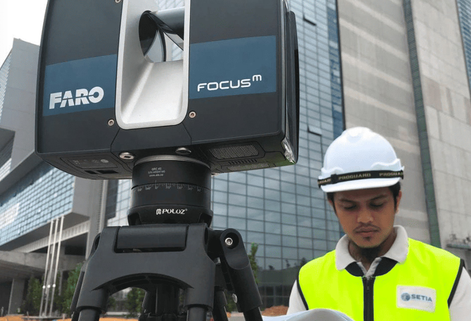
Terrestrial Laser Scanning (TLS) is also known as Terrestrial LiDAR.
The term LiDAR, Light etection and Ranging basically consist of laser rangefinder that operates on top of a tripod or any other platform.
The rangefinder takes repeated measurements of the distances from the platform to the surfaces of the structure.
The position and elevation of the platform are precisely measured by the way of survey principles and referenced to a set of dimensional control points established.
Therefore, the coordinates of the surfaces can be precisely calculated and measured.
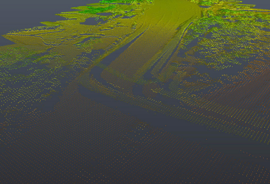
Laser scanning with its high level of accuracy and details is very versatile and has been utilised for example in the Building Information Modeling (BIM), Facility Maintenance Assessments & Asset Management (FM/AM), computing accurate parametric models of complex objects such as piping module and engineering structural purposes.
Building information modelling (BIM) represents the process of development and use of a software-generated model to simulate the planning, design, construction and operation of a building.
The utilization of building information models has increased in recent years due to their economic benefits in design and construction phases and also in building management.
BIM has been widely applied in the design and construction of new buildings but rarely in the management of existing ones.
The purpose of creating a BIM model for an existing building is to produced accurate information related to the building, including its physical and functional characteristics, geometry and inner spatial relationships.
In addition, building renovation is a growing trend in the construction sector.
The amount and granularity of information needed for renovation design are growing in tandem with the fields of architecture, construction, engineering and building management.
Therefore, contractors should not overlook the importance of cost-efficiency.
In order to design cost-efficient renovation works, it is imperative to have accurate data reflecting the existing situation.
This will ultimately be the basis of all design and construction processes to which all consultants and contractors should have access.
Buildings and structures can be visualised three-dimensionally and zoom down till the last detail to perform clashing detections and ensure efficient layout planning.
Finally, the modifications and adaptations are visualised. There is no doubt that laser scanning has become an invaluable resource for layout planning.
GIS stores location data as thematic layers. Each data set has an attribute table that stores information about the feature. The two main types of GIS data are raster and vector.
Laser scanning enables a fast, reliable and inexpensive 3D survey of present structures, buildings and their interior.
Laser scanning is typically used, for example, facades, damages, building documentation as well as to perform dimensionally accurate surveys.
Using the results from the laser scanner, the user is able to create volumes, surfaces, layouts, sectional views and more.
Laser scanning is the optimal method for Building Information Modeling (BIM).
This unique and efficient method is particularly suitable for surveys with regard to modernization, production optimization, upgrades and expansion of production capacity.
As laser scanning is realized without physical contact, 3D surveys could be obtained during machine operations.
Planners, designers and plant engineers benefit tremendously from inexpensive and actual as-built plans which reduces error and misjudgements, thus, ensuring the success of the project.
Cadastral Survey
Aerial Mapping Survey
Engineering Survey
Hydrographic Survey
Underground Utilities
Detection & Mapping
Geographical Infomation System (GIS)
Terrestrial Laser Scanning
Mobile Mapping System (MMS)
Building Information Modelling (BIM)
3D Laser Scanning Services
As-Built Survey Services
Topographical Survey
Kuala Lumpur
Suite L11-21, Tower 1, Wangsa 118, No.8, Jalan Wangsa Delima, Wangsa Maju, 53300, Kuala Lumpur
T :+(6)03-4144 2344
T: +(6)0386878415
F :+(6)03-4144 2644
E: sgskl@setiageosolutions.com
Whatsapp : +(6)0386878415
© 1959 – 2026. Setia Geosolutions Sdn. Bhd. (ISO 9001:2015 Certified Company). All Right Reserved | Powered by keepdesign
No.152A, Jalan Tasek Timur,
Pusat Perdagangan Tasek Indra,
31400 Ipoh, Perak Darul Ridzuan