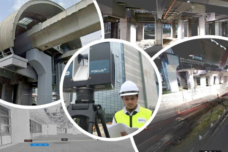
Terrestrial laser scanning (TLS) is a ground-level surveying technique that creates detailed 3D models of buildings or landscapes using laser technology. It’s useful for preserving historic structures, planning renovations, and monitoring the stability of buildings and terrain. TLS helps determine if a structure is moving, tilting or changing in shape, and is particularly valuable when existing plans are outdated or missing. It’s also used to monitor nearby buildings during construction to prevent damage to them. With its ability to quickly and accurately capture the details of complex shapes and spaces, TLS is becoming a popular choice for surveying in construction and preservation projects.
Professional archaeologists and Property Developers utilize data collected from TLS surveys for a variety of environments to support a wide range of geoscience investigations such as detailed mapping of fault-surface roughness. Major Market Segments in Property and Infrastructure, Environmental, Government, Oil and Gas Industries benefit from TLS geodata as repeat TLS surveys allow the imaging and measurement of surface changes through time, arising, for example, from erosion or landslides.
Contact us today and get the assistance you need promptly.
Cadastral Survey
Aerial Mapping Survey
Engineering Survey
Hydrographic Survey
Underground Utilities
Detection & Mapping
Geographical Infomation System (GIS)
Terrestrial Laser Scanning
Mobile Mapping System (MMS)
Building Information Modelling (BIM)
3D Laser Scanning Services
As-Built Survey Services
Topographical Survey
Kuala Lumpur
Suite L11-21, Tower 1, Wangsa 118, No.8, Jalan Wangsa Delima, Wangsa Maju, 53300, Kuala Lumpur
T :+(6)03-4144 2344
T: +(6)0386878415
F :+(6)03-4144 2644
E: sgskl@setiageosolutions.com
Whatsapp : +(6)0386878415
© 1959 – 2026. Setia Geosolutions Sdn. Bhd. (ISO 9001:2015 Certified Company). All Right Reserved | Powered by keepdesign
No.152A, Jalan Tasek Timur,
Pusat Perdagangan Tasek Indra,
31400 Ipoh, Perak Darul Ridzuan