The virtue of maps, they show what can be done with limited space, they foresee that everything can happen therein. ― José Saramago, The Stone Raft
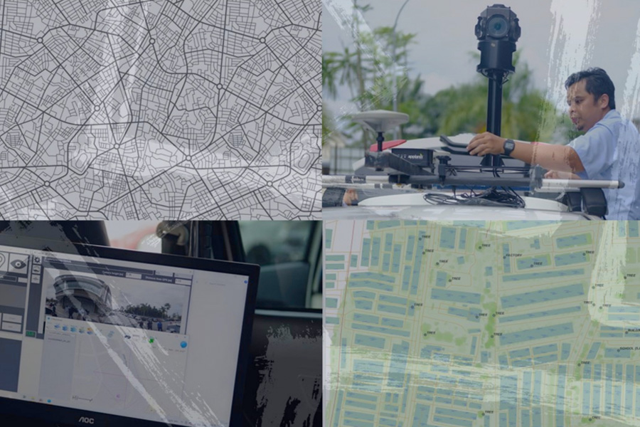
Mobile Mapping System (MMS) technology consist of the photographic image and location information of the objects which are captured by using an omnidirectional digital camera mounted on a moving vehicle with the position determined by high accuracy tracking devices and other sensors.
The key factors that are expected to drive the growth of the mobile mapping market are the growing investments in smart city projects, adoption of advanced technology for surveying and mapping and also increasing in use of geospatial data in most of the application.
Example related application in industry such as large scale mapping and analysing their low-voltage (LV) assets located on-ground and publishing it in Geographic Information System (GIS) platform.
A Mobile Mapping System is a vehicle-mounted geospatial solution that collects high-resolution spatial data using integrated sensors such as LiDAR, GNSS and imaging systems. It enables rapid and efficient data capture along roads, highways, and infrastructure corridors without interrupting traffic flow.
360° Mobile Mapping is a vehicle-mounted system that captures panoramic street-level imagery and geospatial data in a single drive. It provides complete visual coverage of roads and surrounding infrastructure for efficient mapping and inspection.
The 360° view provides complete roadside and corridor visibility, allowing stakeholders to:
Inspect road conditions remotely
Review roadside assets and signage
Conduct visual verification without repeat site visits
Support planning and maintenance decisions
This significantly improves operational efficiency and reduces field revisit requirements.
The platform is particularly suitable for:
Road and highway corridor documentation
Municipal asset inventory
Urban planning and smart city initiatives
Utility infrastructure assessment
Construction progress monitoring
Site condition recording before and after project execution
It is ideal for long linear assets and large-scale infrastructure networks.
Depending on project requirements, deliverables may include:
All outputs are structured to support engineering and asset management workflows.
Drone mapping is suitable for aerial coverage of open areas. A 360° mobile mapping platform captures ground-level panoramic imagery along transport corridors, offering detailed roadside and infrastructure-level visibility that drones may not capture at street level.
In most cases, data acquisition can be conducted within normal traffic flow since the system operates from a moving vehicle. This minimises disruption and enhances operational safety compared to static survey methods.
Yes. One of the key advantages of a 360° platform is the ability to conduct remote visual inspection and review. Stakeholders can assess site conditions, assets, and infrastructure environments without immediate physical site visits.
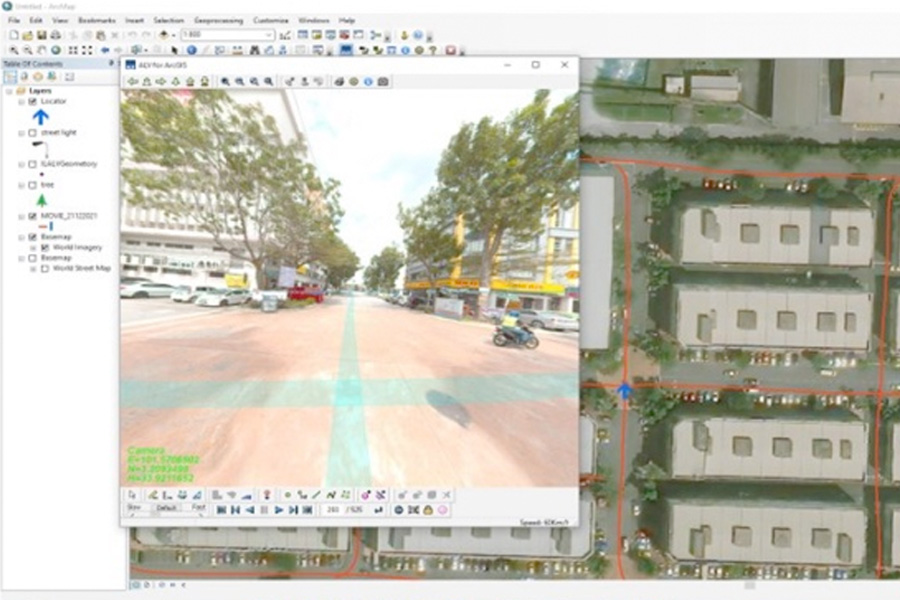
Yes. The platform is designed to support integration with GIS and infrastructure management systems, enabling spatial referencing, asset tagging, and mapping analysis.
Our major clients consist of Local Authority, Government, Utility Service, Provider. Waste Management Division and Highway Concessionaries. Our proven track records:-
Kuala Lumpur
Suite L11-21, Tower 1, Wangsa 118, No.8, Jalan Wangsa Delima, Wangsa Maju, 53300, Kuala Lumpur
T :+(6)03-4144 2344
T: +(6)0386878415
F :+(6)03-4144 2644
E: sgskl@setiageosolutions.com
Whatsapp : +(6)0386878415
© 1959 – 2026. Setia Geosolutions Sdn. Bhd. (ISO 9001:2015 Certified Company). All Right Reserved | Powered by keepdesign
No.152A, Jalan Tasek Timur,
Pusat Perdagangan Tasek Indra,
31400 Ipoh, Perak Darul Ridzuan