News That Matters to You

Dive into a world where accurate information meets insightful analysis, giving you everything you need to stay informed about the issues that matter most to you. Furthermore stay connected with the world around you through our news service, where clarity and relevance are our priority. With real-time updates and expert perspectives, you can rely on us to keep you equipped with knowledge.

Common Challenges in UAV Mapping Projects (and How to Overcome Them)
16Apr

Common Challenges in UAV Mapping Projects (and How to Overcome Them)

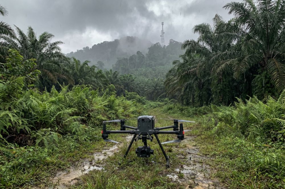
Common Challenges in UAV Mapping Projects (and How to Overcome Them) While UAV mapping offers significant advantages in speed, efficiency,

Types of UAV Mapping: Photogrammetry vs LiDAR
16Apr

Types of UAV Mapping: Photogrammetry vs LiDAR

Types of UAV Mapping: Photogrammetry vs LiDAR As UAV mapping becomes a critical tool across industries such as construction, surveying,

UAV Mapping Accuracy: What Affects Precision?
16Apr

UAV Mapping Accuracy: What Affects Precision?

UAV Mapping Accuracy: What Affects Precision? When it comes to UAV mapping, accuracy is not just a technical metric, it’s

What Is Ground Control Point (GCP) in UAV Mapping?
16Apr

What Is Ground Control Point (GCP) in UAV Mapping?

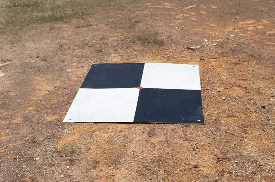
What Is Ground Control Point (GCP) in UAV Mapping? In any professional UAV mapping project, accuracy is everything. Whether you’re

UAV Mapping Workflow: From Flight Planning to Data Output
16Apr

UAV Mapping Workflow: From Flight Planning to Data Output

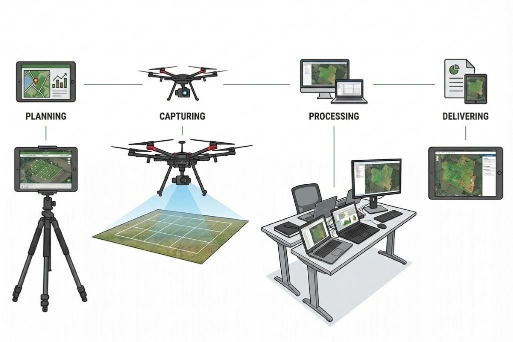
UAV Mapping Workflow: From Flight Planning to Data Output In any successful UAV mapping project, the final accuracy and usefulness

Hydrographic Survey Malaysia: How It Works, Why It Matters, and Who Needs It
01Apr

Hydrographic Survey Malaysia: How It Works, Why It Matters, and Who Needs It

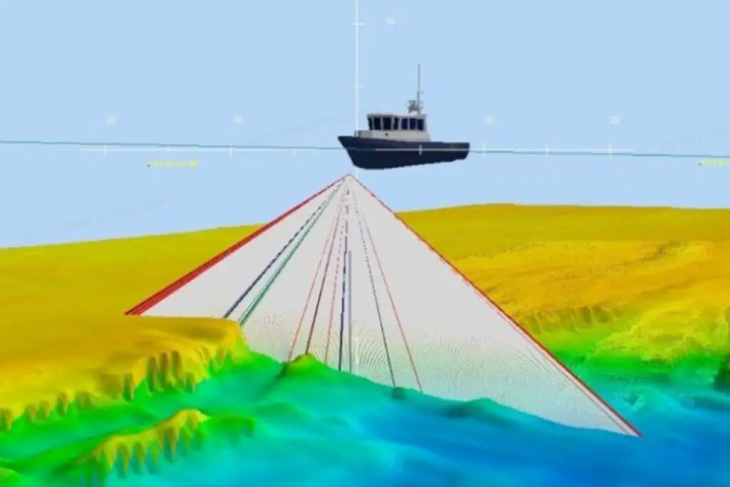
Why Hydrographic Survey Matters in Malaysia Malaysia’s strategic position along the Strait of Malacca and the South China Sea makes

Why You Should Seek a Licensed Land Surveyor
10Mar

Why You Should Seek a Licensed Land Surveyor

Why You Should Seek a Licensed Land Surveyor Land ownership, development and property transactions are significant financial commitments. Yet many

360 Mobile Mapping in Malaysia: A Complete Guide for Infrastructure, Engineering & Asset Owners
05Feb

360 Mobile Mapping in Malaysia: A Complete Guide for Infrastructure, Engineering & Asset Owners

360 Mobile Mapping in Malaysia: A Complete Guide for Infrastructure, Engineering & Asset Owners As infrastructure projects in Malaysia grow

UAV Mapping in Malaysia: A Complete Guide for Construction, Engineering & Development
14Jan

UAV Mapping in Malaysia: A Complete Guide for Construction, Engineering & Development

UAV Mapping in Malaysia: A Complete Guide for Construction, Engineering & Development As construction and infrastructure projects in Malaysia become

Perak Office

No.152A, Jalan Tasek Timur,
Pusat Perdagangan Tasek Indra,
31400 Ipoh, Perak Darul Ridzuan